Major Research Areas
Lower Chesapeake Bay Basin
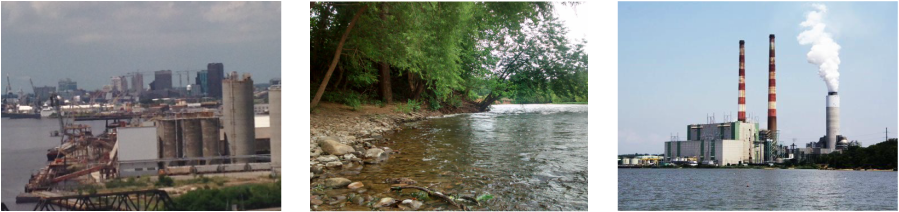
The spatial and temporal distributions of trace metals and microplastics (MPs) are being studied. We are determining the presence of MPs in fluvial sediments and surface waters. Assessing the degree and pattern of which MPs are entering and distributing throughout river systems gives insight in how wastewater treatment plant outflow impacts the natural environment. We are assessing the levels of trace metals as a result of leaching from coal ash disposal from proximal powerplants. Doing so helps evaluate how anthropogenic developments for electricity generation alter the chemistry of water and sediments of affected areas.
The spatial and temporal distributions of trace metals and microplastics (MPs) are being studied. We are determining the presence of MPs in fluvial sediments and surface waters. Assessing the degree and pattern of which MPs are entering and distributing throughout river systems gives insight in how wastewater treatment plant outflow impacts the natural environment. We are assessing the levels of trace metals as a result of leaching from coal ash disposal from proximal powerplants. Doing so helps evaluate how anthropogenic developments for electricity generation alter the chemistry of water and sediments of affected areas.
Chesapeake Bay Sub-watersheds (Central and Northern Virginia)
Ni River and Sugarland Run watersheds: We are evaluating the role of forested buffers and floodplain soil properties on fluvial system phosphorous (P) dynamics, especially in Piedmont sub-basins where storage of P in agricultural legacy sediment is greatest.
We are also starting to take a closer look at the implications of climate change on soil and sediment P adsorption/desorption dynamics in the lower basin of the Rappahannock River system and associated coastal wetlands.
|
|
Rappahannock River System (Northern Virginia)
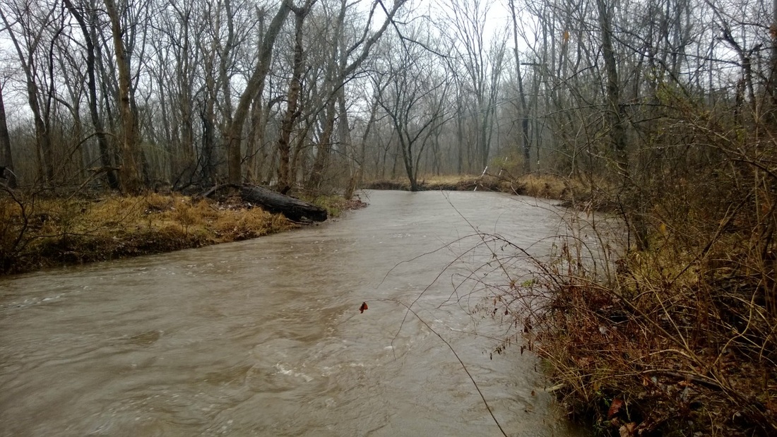
The Rappahannock River is large river system in northern Virginia which runs through Fredericksburg. The river stretches from the Blue Ridge Mountains southeast to the Chesapeake Bay over ~290 km away and has a drainage basin of ~6,920 sq. km. The major land use within the watershed is agricultural, with a recent increase in construction activity along the I-95 corridor near Fredericksburg. Past sediment load monitoring efforts conducted by the USGS indicate that the Rappahannock River, per unit area, is the greatest sediment contributing tributary of the Chesapeake Bay. Our studies within the Rappahannock basin are devoted to the study and quantification of watershed sediment flux rates; as well as evaluation of the environmental impact of high sedimentation rates.
Questions to be answered include: What role do anthropogenic stressors play on the overall sediment load of the river? Which land uses contribute the most sediment to the river? What is the effect of ATV trails and improper storm water management on sub-watershed water quality?
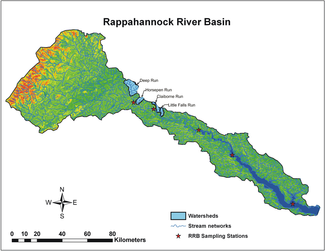
Total Rappahannock River basin.
|
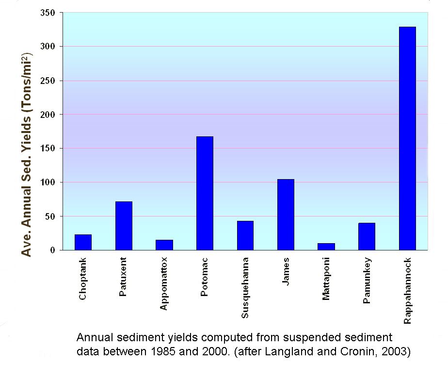
The Rappahannock River has the highest annual sediment load of any Chesapeake Bay tributary
|
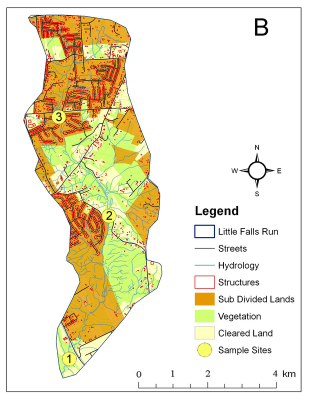
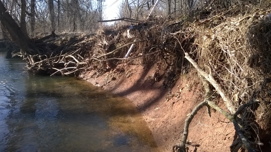
Example of an urbanizing Rappahannock subwatershed
|
Virginia Reservoirs (State-Wide in Virginia)
Lake Moomaw, Lake Pelham, Ni Reservoir: We are analyzing how land use/land cover and watershed geomorphic properties influence sedimentation rates in Piedmont and Blue Ridge reservoirs of Virginia. We also have been isolating sediment sources from both watershed and stream/reservoir bank erosion. To accomplish these goals we use combinations of isotopic analyses (Pb-210, Cs-137), spatial modelling (geographic information systems), and stream bank monitoring (erosion pins).
In addition, we are interested in quantifying lacustrine trace metal influx rates and their relation to anthropogenic land use and atmospheric deposition.
|
|
|
Lake Anna (Central Virginia)
Lake Anna is located in central Virginia, 40 km southwest of Fredericksburg. The lake is located in Louisa, Orange and Spotsylvania counties and is comprised of the former North Anna River. In 1972, Virginia Electric and Power Company, now Dominion Virginia Power, impounded the North Anna River creating Lake Anna 46 sq. km reservoir with a 900 sq. km drainage basin. Lake Anna provides condenser cooling water for the North Anna Nuclear Power Station. Adjoining Lake Anna is a 14 sq. km Waste Heat Treatment Facility (WHTF). The WHTF receives cooling water and transfers the excess heat from the cooling water to the atmosphere prior to discharge into the lower lake, near the dam. Previous studies on this lake have typically focused on nutrients or trace metals and most recently three sections of Lake Anna are included in the 2004 §303(d) Report on Impaired Waters due to the presence of polychlorinated biphenyls (PCBs) in fish tissue.
Questions to be answered include: Where are the major areas of sediment contribution to the lake? What is the annual sediment accumulation rate within the lake? Are PCBs coming from external or internal sources?
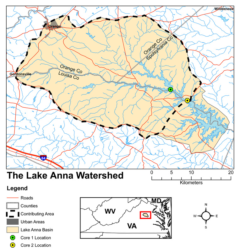
The Lake Anna reservoir basin.
|
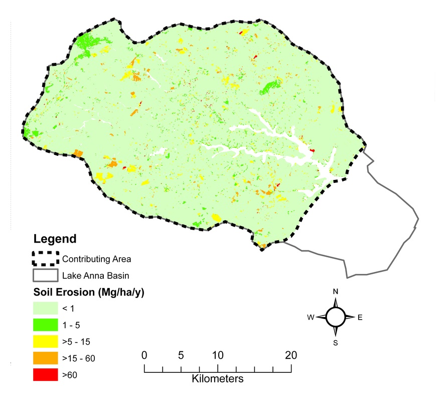
Estimated soil erosion for the upper Lake Anna basin.
|
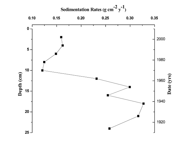
Pb-210 CRS model showing differences in sedimentation over time in Lake Anna.
|
Chincoteague-Assateague Bay (Eastern Shore, Virginia)
Lagoons provide ideal conditions for stable marsh communities that are ecologically important in terms of species diversity. Found on the Eastern Shore spanning the border of Maryland and Virginia, the Chincoteague lagoon is protected along its length by Assateague Island, but is exposed to tidal influences through the Ocean City Inlet to the North and the Chincoteague Inlet to the South. The Chincoteague and Assateague lagoonal systems harbor many acres of ecologically important marshlands. Historically pristine, and still pristine in comparison to its Del Marva counterparts, the two bays are beginning to show signs of deteriorating health and environmental stress.
Our research in this area focuses on the environmental impact of anthropogenic changes in sedimentation rates and trace metal and nutrient content creating a detailed history of contamination of the Chincoteague and Assateague bays over the past century.
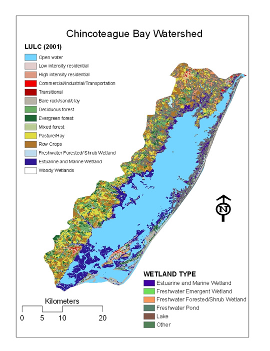
Chincoteague lagoon and surrounding land use.
|
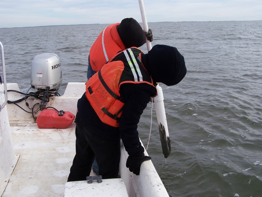
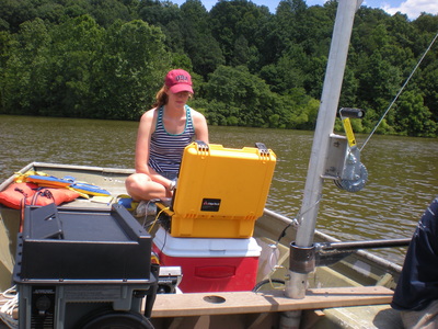
Collecting sediment samples for analysis.
|
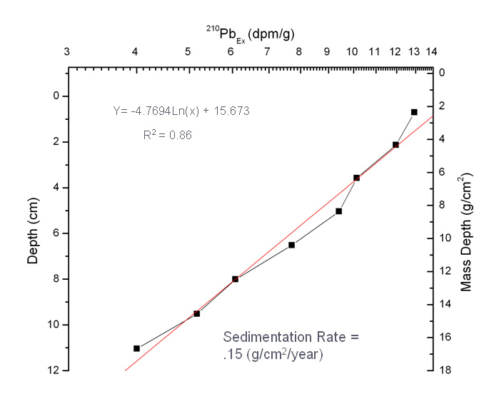
210-Pb profile from a Chincoteague sediment core.
|
